


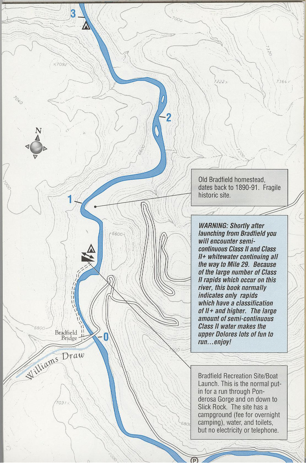


40 pages of mile-by-mile maps from Bradfield Bridge to the confluence with the Colorado 171 miles later. With notes on rapids and points of interest. The first and only comprehensive river guide for the Dolores River. Reprinted from the 1997 edition. Forty pages, spiral bound, on water resistant paper
Rivers are living environments of the earth, changing constantly as the water ebbs and flows through the years. Natural and man-made erosion can shift its course and introduce new rapids or change the character of known areas along the river.
This river guide was last revised in 1997. Please understand the river may be quite different on your boating trip today. Please use this guide as a reference for how the river was and enjoy the rich interpretive materials this guide has to offer.
This river guide was last revised in 1997. Please understand the river may be quite different on your boating trip today. Please use this guide as a reference for how the river was and enjoy the rich interpretive materials this guide has to offer.
Vendor: Public Lands Interpretive Association