arrow-right cart chevron-down chevron-left chevron-right chevron-up close menu minus play plus search share user email pinterest facebook instagram snapchat tumblr twitter vimeo youtube subscribe dogecoin dwolla forbrugsforeningen litecoin amazon_payments american_express bitcoin cirrus discover fancy interac jcb master paypal stripe visa diners_club dankort maestro trash

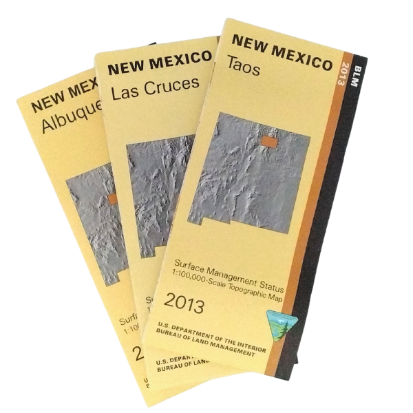
BLM Maps

BLM Map Features

  • scale approximately 3/4"= 1 mile (1:100,000 metric scale)
  • surface management (land ownership) shown in color
  • topographic info (contour interval 50 meters or about 150 feet)
  • spot elevations
  • township and range
  • water features
  • highways, roads, and trails
  • township and range
  • BLM maps cover entire state; each map area covers about 30 x 50 miles (30X60 minutes)
  • metric conversion tables
  • mineral management version available for some maps

Filter by

Price
The highest price is $19.99
$
$
Category
0 selected
Filter and sort

Filter and sort

743 products


Price

Price

The highest price is $19.99

$
$
Category

Category

Map: Mount Hood OR - OR042S

Map: Mount Hood OR - OR042S

$8.99

/

Map: Yamhill River OR (MINERAL) - OR060SM

Map: Yamhill River OR (MINERAL) - OR060SM

$8.99

/

Map: Rogerson ID - ID1056S

Map: Rogerson ID - ID1056S

$8.99

/

Map: Cheyenne WY - WY010S

Map: Cheyenne WY - WY010S

$8.99

/

Map: Denver West CO - CO118S

Map: Denver West CO - CO118S

$8.99

/

Map: Madras OR - OR036S

Map: Madras OR - OR036S

$8.99

/

Map: Ritzville WA - WA032S

Map: Ritzville WA - WA032S

$8.99

/

Map: Coos Bay OR - OR013S

Map: Coos Bay OR - OR013S

$8.99

/

Map: Ukiah CA - CA540S

Map: Ukiah CA - CA540S

$8.99

/

Boater's Guide: Upper Missouri River Breaks (MT) - Judith Landing to James Kipp Recreation Area - 2017

Boater's Guide: Upper Missouri River Breaks (MT) - Judith Landing to James Kipp Recreation Area - 2017

Sold Out

/

Map: Yreka CA - CA565S

Map: Yreka CA - CA565S

$8.99

/

Map: Cuddeback Lake CA - CA095S

Map: Cuddeback Lake CA - CA095S

$8.99

/

Map: Owlshead Mountains CA - CA320S

Map: Owlshead Mountains CA - CA320S

$8.99

/

Map: Hoopa CA - CA195S

Map: Hoopa CA - CA195S

$8.99

/

Map: Happy Camp CA - CA180S

Map: Happy Camp CA - CA180S

$8.99

/

Map: Delta UT - UT106S

Map: Delta UT - UT106S

$8.99

/

Map: Pahute Mesa NV - NV149S

Map: Pahute Mesa NV - NV149S

$8.99

/

Map: Crescent OR - OR017S

Map: Crescent OR - OR017S

$8.99

/

Map: Wallowa OR - OR058S

Map: Wallowa OR - OR058S

$8.99

/

Map: Astoria/Ilwaco OR

Map: Astoria/Ilwaco OR

Sold Out

/

Map: Logan UT - UT119S

Map: Logan UT - UT119S

$8.99

/

Map: Fish Springs UT - UT110S

Map: Fish Springs UT - UT110S

$8.99

/

Map: Mount Adams WA - WA018S

Map: Mount Adams WA - WA018S

$8.99

/

Map: Kalispell MT - MT1102S

Map: Kalispell MT - MT1102S

$8.99

/

Thank you for shopping with us!

Every purchase through our online store aids our mission of educating and inspiring users of public lands. Through our educational programs, interpretive projects, and visitor services, we aim to make public lands accessible and understandable to all.